
Level IV Ecoregions (EPA) of Continental US
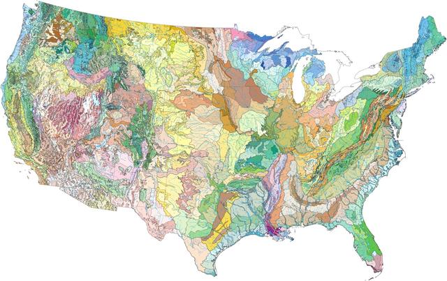
This unlabeled map shows the Level IV ecoregions of the continental U.S., as defined by the US EPA. This map is included in our blog post on using ecoregions over political boundaries, primarily as a graphical illustration of just how much detail can be captured in these regions. It is also strongly evident at a glance how these regions do not correspond to county or state boundaries, instead following major geographical features like mountain ranges, flat regions, and the coastline.