
Home » Regions » North America » Northern Forests » Atlantic Highlands » Northeastern Highlands » Tug Hill Plateau
Tug Hill Plateau
Last updated: September 8th, 2020
Page contents
↑About the Tug Hill Plateau
The Tug Hill Plateau is a round, flat-topped region in upstate New York, east of lake Ontario, markedly elevated from its surroundings.The region has a core of sandstone that is less erodible than surrounding shale and siltstone, leading it to rise higher than surrounding areas. The sandstone is covered with dense glacial till, and soils are generally formed on the till. The climate is humid and continental, with high precipitation produced by a combination of orographic lift and lake effect. The region receives 45-55 inches of rainfall equivalent in most of the region, reaching to over 60 inches in some areas, including significant winter snowfalls. Although the lake increases precipitation, it does little to moderate the climate, and the growing season here is short, with an average of 90-130 frost-free days, dramatically shorter than that in lowland areas. Soils here are spodosols, acidic, well-drained soils, low in fertility, that are typical of coniferous forests farther north.
Original forest cover was a mix of red spruce (Picea rubens) and eastern hemlock (Tsuga canadensis) with northern hardwoods, including sugar maple (Acer saccharum), American beech (Fagus grandifolia), and yellow birch (Betula alleghaniensis). However, this area was cleared by extensive logging and utilized for agriculture for some time, even though it was poorly suited to this use. Agriculture has declined, and in the mid-20th century, the region began to be almost completely reforested, some through natural processes and some through the planting of plantations for forestry.
Current forest cover is in earlier successional stages. There is some beech-maple forest, but also earlier successional species including black cherry (Prunus serotina), white ash (Fraxinus americana), and red maple (Acer rubrum). Plantations tend to be of mixed pines, containing a mix of native eastern white pine (Pinus strobus) and red pine (Pinus resinosa), locally-introduced jack pine (Pinus banksiana) and white spruce (Picea glauca), and trees from other continents, including austrian pine (Pinus nigra), Scots pine (Pinus sylvestris), Norway spruce (Picea abies), and European larch (Larix decidua).
In addition to forests, there are a variety of wetlands in the region. Depending on the site, these are variably dominanted by spruce and balsam fir (Abies balsamea), hemlock and hardwoods, swamps with red maple and other hardwoods, bogs with black spruce (Picea mariana) and tamarack (Larix laricina), scrub alder swamps, and sedge meadows along streams.
There is now almost no agriculture in the region, and the population is low; the largest town is Redfield, with only a few hundred people. Population in the region peaked in the late 1800's when agriculture was more active here. Current land use includes wind farms, forestry, and recreation.
This region is entirely surrounded by the Tug Hill Transition, a sloping region of intermediate elevation and climate that represents a gradual transition between this region and the surrounding lowlands.
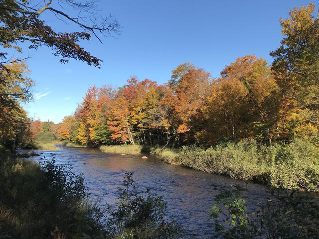 The Mad River, pictured hear near Montague NY, is a tributary to the Salmon River, which flows off of Tug Hill and into Lake Ontario. This is a crop of a photo © AbijahWorth (Wikimedia Commons), CC BY-SA 4.0.
Plant Lists & In-Region Search
We do not yet have data to generate plant lists for a region as fine-tuned as this one. However you can move up to the broader Northeastern Highlands and generate lists for that region: native plants or all plants. Or search that region's plants here:
↑References
1. Bryce, S.A., Griffith, G.E., Omernik, J.M., Edinger, G., Indrick, S., Vargas, O., and Carlson, D. "Ecoregions of New York (Poster)", U.S. Geological Survey (2010) Web.