
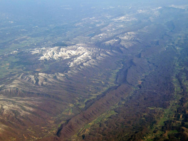
Aerial Photo of Appalachian Ridge & Valley, Washington County, Virginia
Taken on Nov. 3, 2012
This aerial photo shows the Ridge & Valley system close to its center. The long, unbroken ridge is sandstone; to the left are dissected ridges & knobs. The lower areas contain shale valleys with more rugged terrain and forest cover, and limestone/dolomite valleys which are flatter and have more agriculture. This is one of the more rugged parts of the Ridge & Valley system; in areas it is much lower and flatter. Crop of a photo © James St. John.