
Home » Regions » North America » Arctic Cordillera
Arctic Cordillera
Last updated: July 21st, 2020
Page contents
↑Map Legend & Subregion List
| Name | † | Color on Map |
| Ellesmere and Devon Islands Ice Caps | ○ | |
| Baffin and Torngat Mountains | ○ |
† Status: ✓ = Complete ○ = Needs Image … = Incomplete ∅ = Stub Only
↑Progress
Partially Complete | With Images | Complete w/ Images |
Get involved! You can help our ecoregion articles progress faster. Help us find photos of these regions. Contact us if you have any additions or corrections to any of these articles. You can also donate to support our ongoing work.
↑About the Arctic Cordillera
The Arctic Cordillera is a chain of mountain ranges in the arctic. It is one of the northernmost features of North America. It begins in the northeasternmost part of the Labrador Peninsula and extends along the eastern coast of Nunavut. The largest contiguous chunks are on Baffin Island and Ellesmere Island. Where this region borders the ocean, the coastline consists of deep fjords that turn into steep-walled U-shaped valleys inland. This topography is the result of glaciers, contrasting with the V-shaped valleys formed by erosion from liquid water.Plant life in this region is sparse, owing to the harsh conditions. Much of the region is covered by permanent snow and ice, and the areas that are not mostly consist of bare rock and are exposed to very low temperatures. Continuous permafrost covers the entire region; surface thawing happens only in summer, and is often short-lived as even summer temperatures are frequently below freezing. Precipitation is negligible, ranging from 200 to 600mm, with more precipitation in the warmer, southerly regions.
Much of this region borders Tundra at lower altitudes where the land slopes gradually into the sea, and borders the ocean directly where the coastline is steep. The southernmost part of this region, on the Labrador Peninsula, borders Taiga. This area, much within Torngat Mountains National Park, represents the part of the Arctic Cordillera richest in plant biodiversity, as more extensive plant growth is able to survive in the valleys.
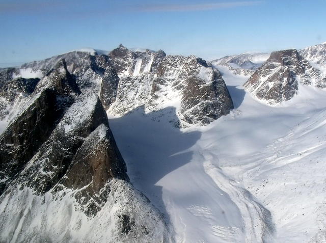 Most of this region is covered by barren landscapes of glaciers, snow, and steep surfaces of bare rock. This photo was taken from a plane; much of this region is extremely difficult to access. Photo © Mike Beauregard, CC BY 2.0.
Plant Lists & In-Region Search
List Native Plants - List All Plants
Warning! This region extends outside the lower 48 US. We have only completed range maps for all plants in the lower 48 US; these lists and searches may thus have omissions for species which only occur in the portion of this region outside the lower 48 US.