
Home » Regions » North America » Eastern Temperate Forests » Mixed Wood Plains » Northern Allegheny Plateau » Finger Lakes Uplands and Gorges
Finger Lakes Uplands and Gorges
Last updated: January 3rd, 2020
Page contents
↑About the Finger Lakes Uplands and Gorges
The Finger Lakes Uplands and Gorges is a region located in upstate New York, irregularly-shaped but extending mostly east-west. This region can be seen as a transition between the Northern Allegheny Plateau to the south, and the Ontario Lowlands to the north, but it also contains some unique characteristics distinguishing it from both of these regions, most imporantly, the 11 finger lakes, which extent north-south. The largest lake, Seneca, has an average depth greater than Lake Ontario (the deepest of the Great Lakes) and never freezes over. The second-largest lake, Cayuga, is also quite deep and usually only freezes partly at its shallower southern end.This region is underlain by soft shale bedrock, which is easily eroded. Deep, v-shaped valleys that predate the most recent glacial period were carved by glaciers into deeper, wider, U-shaped glacial troughs. The terminal moraine left by the glaciers blocked the drainage of water from these valleys, forming the finger lakes that we see today. The region is characterized both by an abundance of these lakes, and deep gorges that have formed after the recent glaciation, a testimony to how quickly the bedrock here is eroded.
Limestone-rich glacial till has produced fertile agricultural soils in parts of this region, more common in the north. Soils produced from the original substrates here tend to be less suited for farming.
The region has a humid continental climate with a fairly long frost-free growing season of 130-190 days. The deep lakes store significant heat and moderate the climate in immediate proximity to them; farther from the lakes, frosts happen more readily and extreme temperatures are more common.
Natural forest cover here was a mix of different forest types. Drier slopes supported Appalachian oak forest, with a mix of oaks, hickory, and American chestnut. Open ridges were covered with a mix of black oak, white oak, northern red oak, chesnut oak, eastern white pine, and pitch pine. Moister sites were dominated by American beech, sugar maple, eastern hemlock, American basswood, and tulip tree. Steep ravines had Eastern hemlock on the steepest slopes and American basswood, bitternut hickory, and tulip tree. Swamps, river floodplains, and parts of glacial troughs on land had forests of black ash, sugar maple, and American elm.
Significant portions of the forests here have been cleared for agriculture, although some forest remains. Farming is more intensive in the north, and population density is higher there as well. Agricultural production here includes dairy, forage crops, orchard fruit, wine grapes, truck crops, and nursery stock. There is also some tourism and recreation in this area. Cities here include Ithaca and Cortland.
This region is bordered by the lower, flatter Ontario Lowlands to the north, and the more rugged, upland Glaciated Low Allegheny Plateau to the south. At the west there is a small border with the ecologically-similar Cattaraugus Hills, differentiated primarily by its lack of a glacial moraine blocking drainage. At the east, this region opens up into the Mohawk Valley.
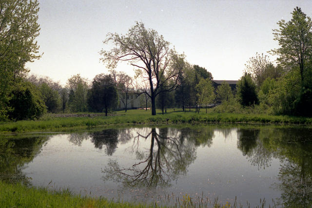 The water in the finger lakes region helps moderate the climate, leading to a greater portion of Vineyards located here. Photo © Phillip Capper, CC BY 2.0.
Plant Lists & In-Region Search
We do not yet have data to generate plant lists for a region as fine-tuned as this one. However you can move up to the broader Northern Allegheny Plateau and generate lists for that region: native plants or all plants. Or search that region's plants here:
↑References
1. Bryce, S.A., Griffith, G.E., Omernik, J.M., Edinger, G., Indrick, S., Vargas, O., and Carlson, D. "Ecoregions of New York (Poster)", U.S. Geological Survey (2010) Web.