
Home » Regions » North America » Eastern Temperate Forests » Ozark, Oauchita-Appalachian Forests » Western Allegheny Plateau » Permian Hills
Permian Hills
Last updated: July 3rd, 2026
Page contents
↑About the Permian Hills
The Permian Hills are a region in the center of the Western Allegheny Plateau, located in northwestern West Virginia, southeast Ohio, and a small corner of southwestern Pennsylvania. The Permian Hills are entirely surrounded by the lower-elevation Monongahela Transition Zone.This region is a steeply dissected plateau. Most of the region is consistently hilly, with the only flat areas being narrow areas along rivers and larger streams, but there are a few areas, particularly in Ohio, where the plateau is less eroded and there are some flatter uplands, and there are also a few broader valley bottoms along Parkersburg, WV and some of the nearby rivers. The climate is slightly cooler than the surroundings.
Original forest cover is not well known, but was probably mostly Appalachian oak forest, with American chestnut (Castanea dentata), some areas of mixed mesophytic forest, oak-sugar maple forest, and beech forest.
This area has less intensive land use than the surrounding areas, owing in large part to its steepness, lower accessibility, and lower suitability to most modern human uses. There is some coal mining and gas extraction, but less than the surroundings. There was more agriculture here in the past, but the steep hillsides are poorly-suited to Western agriculture and much of the farmland has been abandoned and reverted to forest. In upland areas, topsoil has been stripped by overgrazing or poor agricultural practices. What little agriculture remains is mostly corn or hay production, with some pastureland. In the flatter portions of this region in Ohio there is more dairy and livestock production, and general farming.
This region is sparsely populated. The largest city, and only urban area of any significant size in the region, is Parkersburg, West Virginia. Although this area is mostly forested, there is little public protected land, mostly at Wayne National Forest which straddles the western border of this region; this forest was founded as part of a reforestation program in the late 1930's.
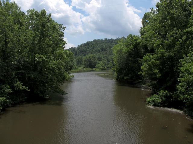 This scenery of forested hills, showing the McKim Creek upstream from County Road 3 in Union Mills, WV, in Pleasants County, is typical of this region. Photo © Malepheasant / TimK MSI (Wikipedia), CC BY-SA 3.0.
Plant Lists & In-Region Search
We do not yet have data to generate plant lists for a region as fine-tuned as this one. However you can move up to the broader Western Allegheny Plateau and generate lists for that region: native plants or all plants. Or search that region's plants here:
↑References
1. Woods, A.J, Omernik, J.M., Brown, D.D. "Level III and IV Ecoregions of Delaware, Maryland, Pennsylvania, Virginia, and West Virginia", U.S. Environmental Protection Agency: National Health and Environmental Effects Research Laboratory, Corvallis, OR (1999) Web.