
Home » Regions » North America » Northern Forests » Mixed Wood Shield » Northern Lakes and Forests » Tawas Lake Plain
Tawas Lake Plain
Last updated: August 19th, 2020
Page contents
↑About the Tawas Lake Plain
The Tawas Lake Plain is a region in the lower Peninsula of Michigan, on the western shore of Lake Huron, located north of Saginaw Bay, and extending somewhat inland at its southern end.Most of this region has sandy soil, but the texture varies from dry, excessively well-drained sands to more poorly-drained sands. There are a few areas in the south with clay and silt-based soils.
The climate here is significantly cooler than the regions along the lake to the south. The proximity to the lake slightly moderates the climate, but does not create appreciable lake-effect precipitation due to the west-east movement of most weather systems.
This region was originally mostly forested, with some open wetlands. Ridges along the beach supported northern red oak (Quercus rubra), eastern white pine (Pinus strobus), and red pine (Pinus resinosa). Areas with finer-textured loamy or clay soils, better at holding moisture, supported American beech (Fagus grandifolia), sugar maple (Acer saccharum), eastern hemlock (Tsuga canadensis), and eastern white pine. Poorly-drained flat areas featured a diverse array of wetlands, with dominant trees in forested wetlands including northern white-cedar (Thuja occidentalis), black ash (Fraxinus nigra), tamarack (Larix laricina), eastern hemlock, eastern white pine, and red maple (Acer rubrum). There were marshes along the lakeshore, and shrub swamps in the areas intermediate between the forested swamps and lakeshore marshes.
There is some agriculture in this region, mostly located in the areas with more mesic to poorly-drained soils; much of this land was originally more swampy, and has been tiled and ditched to drain it. The region has both pastureland and cropland, and produces grain, hay, and blueberries. There are some pine plantations on well-drained sandy soils. The rest of the region, including both the driest and swampiest sites, is mostly left as wild forest. Sites that have been logged or cleared and reverted to forest now support earlier-successional forests of balsam fir (Abies balsamea), black spruce (Picea mariana), jack pine (Pinus banksiana), northern white-cedar, and quaking aspen (Populus tremuloides). The region is sparsely populated, with the two largest settlements being Tawas City and Oscoda.
To the south, this region is bordered by the Saginaw Lake Plain, which is warmer and tends to have more clayey, poorly-drained soils, and much more agriculture. To the northwest, this region is bordered by the Mio Plateau, a slightly higher-elevation region with more rugged topography in places, owing to glacial moraines. To the north, along the lake, there is also a small border with the Onaway Moraines, another region with slightly higher elevation and more rugged terrain.
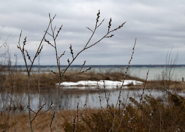 Although wetlands in the Tawas Lake Plain have been reduced by draining, there are still some small proected areas of lakeshore marshes. Pictured here is Tawas Point State Park. Photo © ksblack (Flickr), Public Domain, Source.
Plant Lists & In-Region Search
We do not yet have data to generate plant lists for a region as fine-tuned as this one. However you can move up to the broader Northern Lakes and Forests and generate lists for that region: native plants or all plants. Or search that region's plants here:
↑References
1. Omernik, J.M., Bryce, S.A. "Michigan: Level III and IV Ecoregion Descriptions / Mapping Issues", US EPA (2007) Web.