
Home » Regions » North America » Eastern Temperate Forests » Mixed Wood Plains » Acadian Plains and Hills » Aroostook Lowlands
Aroostook Lowlands
Last updated: September 2nd, 2020
Page contents
↑About the Aroostook Lowlands
The Aroostook Lowlands are a region in northeastern Maine, along the eastern border with New Brunswick; on the Canadian side the region is referred to as the Saint John River Valley.This region ranges from flat to gently rolling plains, with some low hills. There are very few lakes and ponds. The region is mostly covered by thick, loamy glacial till, with some sand and gravel originating from icemelt when glaciers retreated. There is also some peat. The bedrock here is calcium-rich, and the the soils and surface water here tends to be less acidic and more nutrient-rich as a result. The climate here is locally warmer than other inland areas so far north. The combination of more neutral, nutrient-rich soils and milder climate make this area both higher in plant biodiversity and better-suited to western agriculture.
Original forest cover was mostly beech-birch-maple forest with American beech (Fagus grandifolia), yellow birch (Betula alleghaniensis), and sugar maple (Acer saccharum), with eastern hemlock (Tsuga canadensis), red maple (Acer rubrum), white ash (Fraxinus americana), and paper birch (Betula papyrifera), and spruce-northern hardwoods forest with red spruce (Picea rubens), yellow birch, balsam fir (Abies balsamea), and some eastern white pine (Pinus strobus). Early-successional forests following disturbance featured balsam fir and large-tooth aspen (Populus grandidentata).
Currently, this region is heavily utilized for agriculture. Potatoes are the dominant crop, and there is also some pastureland, as well as production of oats, hay, peas, buckwheat, and broccoli. There is still some forest cover here, more on the Canadian side, and there is significant forestry. There is also a small amount of urban and residential development, mostly in the form of small towns, of which there are many throughout the region. The largest city here is Presque Isle, ME, followed by Caribou, ME.
This region is bordered to the west by the Aroostook Hills, to the north and northeast by the Northern New Brunswick Uplands, to the southeast by the Southern New Brunswick Uplands, and to the south by the Eastern Maine-Southern New Brunswick Plains.
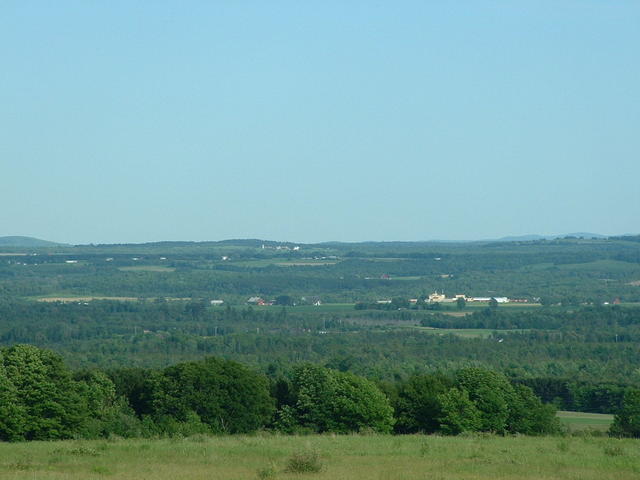 This photo, taken near Houlton, ME, shows a relatively flat landscape, with a mix of land use including agriculture and some residential development, typical of the Aroostook Lowlands. Photo © Michael Surran, CC BY-SA 2.0, Source.
Plant Lists & In-Region Search
We do not yet have data to generate plant lists for a region as fine-tuned as this one. However you can move up to the broader Acadian Plains and Hills and generate lists for that region: native plants or all plants. Or search that region's plants here:
↑References
1. Griffith, G.E., Omernik, J.M., Bryce, S.A., Royte, J., Hoar, W.D., Homer, J.W., Keirstead, D., Metzler, K.J., and Hellyer, G. "Ecoregions of New England (Poster)", U.S. Geological Survey (2009) Web.