
Home » Regions » North America » Eastern Temperate Forests » Mississippi Alluvial & Southeast USA Coastal Plains » Middle Atlantic Coastal Plain » Delmarva Uplands
Delmarva Uplands
Last updated: March 26th, 2021
Page contents
↑About the Delmarva Uplands
The Delmarva Uplands are a region located on the interior uplands of the Delmarva peninsula and covering the bulk of the penininsula.The landscape here ranges from gently rolling hills to completely flat. The central ridge of the peninsula, which has only a subtle slope, runs through this region; local relief is at most 50 feet and much less in most places. The most rugged topography is found in the northwest of the region, with cliffs and gorges along the Chesapeake bay; the highest point of the region is located here, at Stillpond Neck, Maryland, and is only 102 ft (31 m) above sea level. Especially along the eastern shore of the Chesapeake bay, there are many wet, shallow depressions with sandy rims, similar to the Carolina Bays farther south, and sometimes called Delmarva Bays.
The climate here is mild and temperate, with a long growing season and ample precipitation, roughly evenly distributed throughout the year. The region is part of the coastal plain and is underlain by unconsolidated sediments that originated under shallow ocean when sea level was higher. Soils here are mostly sandy and poor at holding water, but some poorly-drained soils also occur. Overall, soils are nutrient-poor.
The original forest types here are not well known. They have been mapped mostly as Oak-Hickory-Pine forest, perhaps with some pine barrens, also including gray birch in the north. Besides various oaks, hickories, and pines, these forests probaly also contained American beech (Fagus grandifolia) and American sweetgum (Liquidambar styraciflua). Pines were mostly loblolly pine (Pinus taeda) with some Virginia pine (Pinus virginiana), contrasting with the shortleaf and longleaf pine in this forest type farther south. Delmarva bays were filled grasses and sedges, along with common buttonbush (Cephalanthus occidentalis) and coastal sweetpepperbush (Clethra alnifolia). There were also a few bald cypress (Taxodium distichum) swamps, with the northernmost located near the southern border of Delaware.
The original forests here have been cleared, and nowadays this area is heavily utilized for agriculture. Major crops include corn, soybeans, fruits, and assorted truck crops. There is also significant poultry, livestock, and dairy farming, and some commercial forestry. About two-thirds of the Delmarva bays have been altered or drained for agriculture.
This area is much less urbanized than other nearby regions on the East Coast, although in recent years suburban residential development has increased, especially in the northernmost portion of this region. Parts of the Wilmington, DE metro area are located here, as are the smaller cities of Salisbury, MD and Dover, DE. Most of the area is rural and sparsely populated, especially in the south. Significant wild forest remains, mostly along streams and rivers, and also on the bluffs in the northwest of the region. The forest composition has changed considerably here. Red maple (Acer rubrum), once uncommon here, is now one of the dominant trees. Loblolly pine, although on the rise farther south, has become less abundant here.
The northern boundary of this region, with the Piedmont Uplands is marked by a fall line. A small border of this region to the northwest is marked by a more gradual transition to the slightly hillier Chesapeake Rolling Coastal Plain. To the west, this region transitions into the Chesapeake-Pamlico Lowlands and Tidal Marshes along the eastern shore of the Chesapeake bay. To the east, this region is bordered by the Delaware River Terraces and Uplands along the Delaware river and bay, and farther south, along the ocean, by the Virginian Barrier Islands and Coastal Marshes.
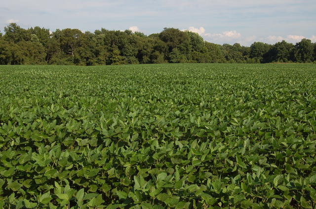 Soybean farming is a common sight in this region. Forests occupy some land in the background. Although some of this region has gently rolling hills, much of it is quite flat, like pictured here. Photo © University of Delaware Carvel REC, CC BY 2.0.
Plant Lists & In-Region Search
We do not yet have data to generate plant lists for a region as fine-tuned as this one. However you can move up to the broader Middle Atlantic Coastal Plain and generate lists for that region: native plants or all plants. Or search that region's plants here:
↑References
1. Woods, A.J, Omernik, J.M., Brown, D.D. "Level III and IV Ecoregions of Delaware, Maryland, Pennsylvania, Virginia, and West Virginia", U.S. Environmental Protection Agency: National Health and Environmental Effects Research Laboratory, Corvallis, OR (1999) Web.