
Home » Regions » North America » Eastern Temperate Forests » Southeastern USA Plains » Northern Piedmont » Piedmont Limestone/Dolomite Lowlands
Piedmont Limestone/Dolomite Lowlands
Last updated: February 26th, 2021
Page contents
↑About the Piedmont Limestone/Dolomite Lowlands
The Piedmont Limestone / Dolomite Lowlands are a region covering much of Lancaster County, Pennsylvania, with narrow regions extending east into southeastern PA and southwest through Maryland, just into Virginia. This region has been severely altered from its original state, with very little forest cover remaining. Because of the irregular shape of this region, it is interspersed with areas of greater forest cover, but these mostly exist outside of the region. Thus most people do not realize the extent to which this particular region and its unique ecosystems have been degraded or eliminated.This region is nearly flat to gently undulating, and is underlain by limestone and dolomite. The soluble substrate creates a Karst topography with sinkholes and caves. The soils here are highly fertile and ideally suitable for Western agriculture; they represent some of the best soils for agriculture anywhere in the eastern United States. This, together with a favorable climate and proximity to major population centers make this one of the most productive agricultural areas in the U.S.
The original forest cover is not well-known, but was probably Appalachian oak forest with small amounts of Oak-Hickory-Pine forest along the Susquehanna river, and some open wetlands. The calcareous soils probably supported a greater concentration of Chinquapin Oak (Quercus muehlenbergii), Common Hackberry (Celtis occidentalis), sugar maple (Acer saccharum), Eastern Redbud (Cercis canadensis), Flowering Dogwood (Cornus florida) and other trees that prefer such soils, than would normally be found in the broader region.
Little forest remains in this region, which is heavily developed for agriculture. In most areas, there are not even any woodlots or riparian buffers, although some forests exist along the Conestoga river and Little Conestoga Creek and a few other smaller creeks, especially west of Lancaster city. There is also significant urbanization and suburbanization, mostly around Lancaster city, but with suburbs of Philadelphia in the easternmost portion of this region as well. Some small fragments of wild forest can be found on hillier sites isolated from development; there is a small amount of protected forest in the Lancaster County Central Park, and the Lancaster Conservancy also maintains some small wild areas, including Shiprock Woods, Windolph Landing, and Turkey Hill Nature Preserves. These small, fragmented habitats often have a large portion of invasive species.
This region is bordered on the south, and at times surrounded, by the Piedmont Uplands, which have higher elevation, more rugged terrain, and less fertile soils. Much of the region borders the Triassic Lowlands to the north, another flat, lowland area with slightly less fertile soils. This region also shares a small border with the much more rugged Trap Rock and Conglomerate Uplands.
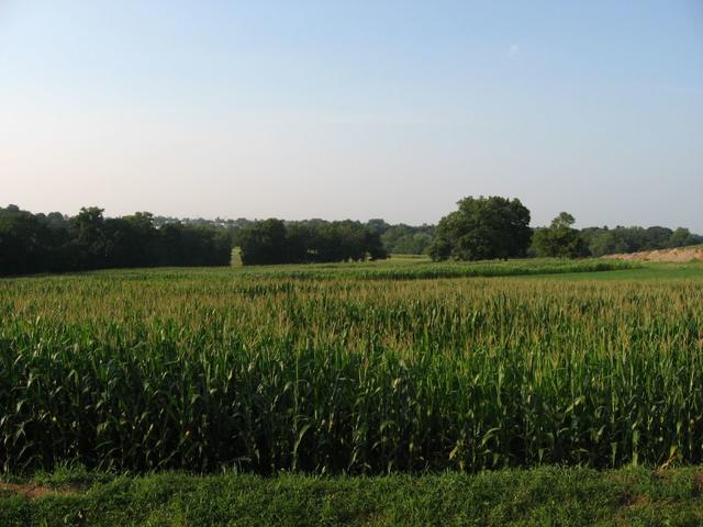 This scenery, showing cropland and mostly flat topography, is the most common sight throughout this region. Photo © Ken Lund, CC BY-SA 2.0.
Plant Lists & In-Region Search
We do not yet have data to generate plant lists for a region as fine-tuned as this one. However you can move up to the broader Northern Piedmont and generate lists for that region: native plants or all plants. Or search that region's plants here:
↑References
1. Woods, A.J, Omernik, J.M., Brown, D.D. "Level III and IV Ecoregions of Delaware, Maryland, Pennsylvania, Virginia, and West Virginia", U.S. Environmental Protection Agency: National Health and Environmental Effects Research Laboratory, Corvallis, OR (1999) Web.